Download Tab - Design Year
When the "Design Year" option is selected at the top of the page on the Download tab, you can select from a range of options that allow you to configure the data to be downloaded according to your design purposes.
There are also some options for more advanced users to control the data generation. These can be accessed by pressing the "Show Options" button.
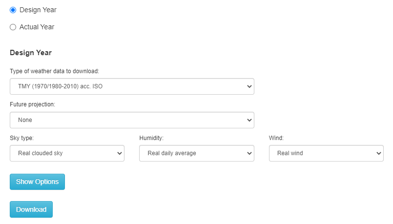
Type of weather data to download
You can select from 3 broad categories of weather data:
-
Real year - you can choose the year
-
Typical year - where each month is selected as the most "typical" based on a range of selection criteria.
-
Extreme year - the most extreme year is selected based on the chosen selection criterion.
Real
-
Real year – When this option is selected, a drop list control is displayed to the right to allow you to select the required year. Note that you can also download data for a specific year through the "Actual Year" option, but that in that case the data will be from the Actual Year hourly database rather than the Design Year daily database.
Typical year data
-
TMY (1970/1980 – 2010) acc. ANSI/ASHRAE – Option selects the most "typical" month for each of the 12 months based on the ANSI/ASHRAE TMY standard selection method.
-
TMY (1970/1980 – 2010) acc. ISO– Option selects the most "typical" month for each of the 12 months based on the ISO TMY standard selection method.
-
TMY (1995-2015) acc. ANSI/ASHRAE – Option selects the most "typical" month for each of the 12 months based on the ANSI/ASHRAE TMY standard selection method using data between 1995 and 2015.
-
TMY (1995-2015) acc. ISO– Option selects the most "typical" month for each of the 12 months based on the ISO TMY standard selection method using data between 1995 and 2015.
-
TRY (1994-2013) acc. CIBSE- Option selects a typical but mild month for each of the 12 months based on the CIBSE TRY standard using data between 1994 and 2013. Note that although this option uses the CIBSE selection method, you must use CIBSE's official files for compliance purposes.
Extreme year data
-
Coldest year - Option selects the coldest year in the period 1970-2021 by comparing the average of the daily average outdoor air temperatures based on the temperature model selected on the Download tab. The year with the coldest annual average daily temperature is selected for download.
-
Average year - Option selects the year in the period 1970-2021 with the most average temperature by comparing the average of the daily average outdoor air temperatures based on the temperature model selected on the Download tab. The year with the most annual average temperature is selected for download.
-
Warmest year - Option selects the warmest year in the period 1970-2021 by comparing the average of the daily average outdoor air temperatures based on the temperature model selected on the Download tab. The year with the warmest annual average daily temperature is selected for download.
-
Most humid year - Selects the most humid year in the period 1970-2021 by comparing the average of the daily average outdoor air relative humidity. The year with the highest daily average relative humidity is selected for download.
-
Least humid year - Selects the least humid year in the period 1970-2021 by comparing the average of the daily average outdoor air relative humidity. The year with the lowest daily average relative humidity is selected for download.
-
ISO/ANSI 1 day Cooling sizing - This option selects the year with the highest maximum temperature over 1 day. The comparison is carried out using the temperature model selected on the Download tab.
-
ISO/ANSI 2 day Cooling sizing - This option selects the year with the highest maximum temperature averaged over 2 days. That is the sequence of 2 days whose maximum temperatures, when averaged, are higher than the average for any other sequence of 2 days. The comparison is carried out using the temperature model selected on the Download tab.
-
ISO/ANSI 3 day Cooling sizing - This option selects the year with the highest maximum temperature averaged over 3 days. That is the sequence of 3 days whose maximum temperatures, when averaged, are higher than the average for any other sequence of 3 days. The comparison is carried out using the temperature model selected on the Download tab.
-
ISO/ANSI 4 day Cooling sizing - This option selects the year with the highest maximum temperature averaged over 4 days. That is the sequence of 4 days whose maximum temperatures, when averaged, are higher than the average for any other sequence of 4 days. The comparison is carried out using the temperature model selected on the Download tab.
-
ISO/ANSI 1 day Heating sizing - This option selects the year with the lowest minimum temperature over 1 day. The comparison is carried out using the temperature model selected on the Download tab.
-
ISO/ANSI 2 day Heating sizing - This option selects the year with the lowest minimum temperature averaged over 2 days. That is the sequence of 2 days whose minimum temperatures, when averaged, are lower than the average for any other sequence of 2 days. The comparison is carried out using the temperature model selected on the Download tab.
-
ISO/ANSI 3 day Heating sizing - This option selects the year with the lowest minimum temperature averaged over 3 days. That is the sequence of 3 days whose minimum temperatures, when averaged, are lower than the average for any other sequence of 3 days. The comparison is carried out using the temperature model selected on the Download tab.
-
ISO/ANSI 4 day Heating sizing - This option selects the year with the lowest minimum temperature averaged over 4 days. That is the sequence of 4 days whose minimum temperatures, when averaged, are lower than the average for any other sequence of 4 days. The comparison is carried out using the temperature model selected on the Download tab.
Note for all ANSI/ISO n-day Heating/Cooling sizing downloads.
You can use the ANSI/ISO 1-4 day sizing option on the Analysis tab to check the selected year, remembering to apply the same temperature model option on both Analysis and Download tabs.
Year
When Real Year is selected as the type of weather data to download, the year can be selected from the list. Select any year from 1970 until the previous year.
Future projection
If you wish the weather file you download to represent a future climate scenario you can select an option to apply an adjustment to the selected historic data to account for future climate change based on a range of scenarios and year bands.
For options selected from the IPCC 2001 and IPCC 2007 lists, adjustments are made to the hourly data based on projected future climate change data stored as monthly min/max temperature, humidity, solar radiation and wind speed differences. Specific adjustments are made for each location using gridded data calculated by the research organisation and provided by the IPCC. For options selected from the Other Sources list, a fixed temperature increment is added to each hour.
You can find out more about the various future climate projection options in the Climate Change Scenarios section.
Tip: You can view the data used for the future climate projection for each station from the Analysis tab by selecting the Monthly Interval and the Future Climate Changes option under Data to plot. Then press the "Update" button followed by the "View Data" button.
IPCC 2001
- None - default setting where no future climate projections are included and weather data is historical.
- Hadley Centre HADCM3_A1F_2010-2039 - High emissions: Rapid Economic Growth/Integrated World/High Fossil Fuel - scenario for years up to 2039.
- Hadley Centre HADCM3_A1F_2040-2069 - High emissions: Rapid Economic Growth/Integrated World/High Fossil Fuel - scenario for period 2040-2069.
- Hadley Centre HADCM3_A1F_2070-2099 - High emissions: Rapid Economic Growth/Integrated World/High Fossil Fuel - scenario for period 2070-2099.
- Hadley Centre HADCM3_A2A_2010-2039 - Medium-high emissions: Slower Development/Regional Differences Maintained - scenario for years up to 2039.
- Hadley Centre HADCM3_A2A_2040-2069 - Medium-high emissions: Slower Development/Regional Differences Maintained - scenario for period 2040-2069.
- Hadley Centre HADCM3_A2A_2070-2099 - Medium-high emissions: Slower Development/Regional Differences Maintained - scenario for period 2070-2099.
- Hadley Centre HADCM3_A2B_2010-2039 - Medium-high emissions: Slower Development/Regional Differences Maintained - scenario for years up to 2039.
- Hadley Centre HADCM3_A2B_2040-2069 - Medium-high emissions: Slower Development/Regional Differences Maintained - scenario for period 2040-2069.
- Hadley Centre HADCM3_A2B_2070-2099 - Medium-high emissions: Slower Development/Regional Differences Maintained - scenario for period 2070-2099.
- Hadley Centre HADCM3_B1A_2010-2039 - Low emissions: Convergent World/Greater Equity/Eco Technologies - scenario for years up to 2039.
- Hadley Centre HADCM3_B1A_2040-2069 - Low emissions: Convergent World/Greater Equity/Eco Technologies - scenario for period 2040-2069.
- Hadley Centre HADCM3_B1A_2070-2099 - Low emissions: Convergent World/Greater Equity/Eco Technologies - scenario for period 2070-2099.
- Hadley Centre HADCM3_B2A_2010-2039 - Medium-low emissions: Convergent World/Greater Equity/Eco Technologies/Local Solutions - scenario for years up to 2039.
- Hadley Centre HADCM3_B2A_2040-2069 - Medium-low emissions: Convergent World/Greater Equity/Eco Technologies/Local Solutions - scenario for period 2040-2069.
- Hadley Centre HADCM3_B2A_2070-2099 - Medium-low emissions: Convergent World/Greater Equity/Eco Technologies/Local Solutions - scenario for period 2070-2099.
- Hadley Centre HADCM3_B2B_2010-2039 - Medium-low emissions: Convergent World/Greater Equity/Eco Technologies/Local Solutions - scenario for years up to 2039.
- Hadley Centre HADCM3_B2B_2040-2069 - Medium-low emissions: Convergent World/Greater Equity/Eco Technologies/Local Solutions - scenario for period 2040-2069.
- Hadley Centre HADCM3_B2B_2070-2099 - Medium-low emissions: Convergent World/Greater Equity/Eco Technologies/Local Solutions - scenario for period 2070-2099.
- Centre for Climate System Research CCSR-NIES_A1a 2010-2039 - High emissions: Rapid Economic Growth/Integrated World - scenario for years up to 2039.
- Centre for Climate System Research CCSR-NIES_A1a 2040-2069 - High emissions: Rapid Economic Growth/Integrated World - scenario for period 2040-2069.
- Centre for Climate System Research CCSR-NIES_A1a 2070-2099 - High emissions: Rapid Economic Growth/Integrated World - scenario for period 2070-2099.
- Centre for Climate System Research CCSR-NIES_A1F 2010-2039 - High emissions: Rapid Economic Growth/Integrated World/High Fossil Fuel - scenario for years up to 2039.
- Centre for Climate System Research CCSR-NIES_A1F 2040-2069 - High emissions: Rapid Economic Growth/Integrated World/High Fossil Fuel - scenario for period 2040-2069.
- Centre for Climate System Research CCSR-NIES_A1F 2070-2099 - High emissions: Rapid Economic Growth/Integrated World/High Fossil Fuel - scenario for period 2070-2099.
- Centre for Climate System Research CCSR-NIES_A1T 2010-2039 - High emissions: Rapid Economic Growth/Integrated World/High Renewables - scenario for years up to 2039.
- Centre for Climate System Research CCSR-NIES_A1T 2040-2069 - High emissions: Rapid Economic Growth/Integrated World/High Renewables - scenario for period 2040-2069.
- Centre for Climate System Research CCSR-NIES_A1T 2070-2099 - High emissions: Rapid Economic Growth/Integrated World/High Renewables - scenario for period 2070-2099.
- Centre for Climate System Research CCSR-NIES_A2a 2010-2039 - Medium-high emissions: Slower Development/Regional Differences Maintained - scenario for years up to 2039.
- Centre for Climate System Research CCSR-NIES_A2a 2040-2069 - Medium-high emissions: Slower Development/Regional Differences Maintained - scenario for period 2040-2069.
- Centre for Climate System Research CCSR-NIES_A2a 2070-2099 - Medium-high emissions: Slower Development/Regional Differences Maintained - scenario for period 2070-2099.
- Centre for Climate System Research CCSR-NIES_B1a 2010-2039 - Low emissions: Convergent World/Greater Equity/Eco Technologies - scenario for years up to 2039.
- Centre for Climate System Research CCSR-NIES_B1a 2040-2069 - Low emissions: Convergent World/Greater Equity/Eco Technologies - scenario for period 2040-2069.
- Centre for Climate System Research CCSR-NIES_B1a 2070-2099 - Low emissions: Convergent World/Greater Equity/Eco Technologies - scenario for period 2070-2099.
- Centre for Climate System Research CCSR-NIES_B2a 2010-2039 - Medium-low emissions: Convergent World/Greater Equity/Eco Technologies/Local Solutions - scenario for years up to 2039.
- Centre for Climate System Research CCSR-NIES_B2a 2040-2069 - Medium-low emissions: Convergent World/Greater Equity/Eco Technologies/Local Solutions - scenario for period 2040-2069.
- Centre for Climate System Research CCSR-NIES_B2a 2070-2099 - Medium-low emissions: Convergent World/Greater Equity/Eco Technologies/Local Solutions - scenario for period 2070-2099.
- Commonwealth Scientific and Industrial Research_CSIRO_A1a_2010-2039 - High emissions: Rapid Economic Growth/Integrated World - scenario for years up to 2039.
- Commonwealth Scientific and Industrial Research_CSIRO_A1a_2040-2069 - High emissions: Rapid Economic Growth/Integrated World - scenario for period 2040-2069.
- Commonwealth Scientific and Industrial Research_CSIRO_A1a_2070-2099 - High emissions: Rapid Economic Growth/Integrated World - scenario for period 2070-2099.
- Commonwealth Scientific and Industrial Research_CSIRO_A2a_2010-2039 - Medium-high emissions: Slower Development/Regional Differences Maintained - scenario for years up to 2039.
- Commonwealth Scientific and Industrial Research_CSIRO_A2a_2040-2069 - Medium-high emissions: Slower Development/Regional Differences Maintained - scenario for period 2040-2069.
- Commonwealth Scientific and Industrial Research_CSIRO_A2a_2070-2099 - Medium-high emissions: Slower Development/Regional Differences Maintained - scenario for period 2070-2099.
- Commonwealth Scientific and Industrial Research_CSIRO_B1a_2010-2039 - Low emissions: Convergent World/Greater Equity/Eco Technologies - scenario for years up to 2039.
- Commonwealth Scientific and Industrial Research_CSIRO_B1a_2040-2069 - Low emissions: Convergent World/Greater Equity/Eco Technologies - scenario for period 2040-2069.
- Commonwealth Scientific and Industrial Research_CSIRO_B1a_2070-2099 - Low emissions: Convergent World/Greater Equity/Eco Technologies - scenario for period 2070-2099.
- Commonwealth Scientific and Industrial Research_CSIRO_B2a_2010-2039 - Medium-low emissions: Convergent World/Greater Equity/Eco Technologies/Local Solutions - scenario for years up to 2039.
- Commonwealth Scientific and Industrial Research_CSIRO_B2a_2040-2069 - Medium-low emissions: Convergent World/Greater Equity/Eco Technologies/Local Solutions - scenario for period 2040-2069.
- Commonwealth Scientific and Industrial Research_CSIRO_B2a_2070-2099 - Medium-low emissions: Convergent World/Greater Equity/Eco Technologies/Local Solutions - scenario for period 2070-2099.
- Canadian Global Coupled Model_CCCMA_A2a_2010-2039 - Medium-high emissions: Slower Development/Regional Differences Maintained - scenario for years up to 2039.
- Canadian Global Coupled Model_CCCMA_A2a_2040-2069 - Medium-high emissions: Slower Development/Regional Differences Maintained - scenario for period 2040-2069.
- Canadian Global Coupled Model_CCCMA_A2a_2070-2099 - Medium-high emissions: Slower Development/Regional Differences Maintained - scenario for period 2070-2099.
- Canadian Global Coupled Model_CCCMA_B2a_2010-2039 - Medium-low emissions: Convergent World/Greater Equity/Eco Technologies/Local Solutions - scenario for years up to 2039.
- Canadian Global Coupled Model_CCCMA_B2a_2040-2069 - Medium-low emissions: Convergent World/Greater Equity/Eco Technologies/Local Solutions - scenario for period 2040-2069.
- Canadian Global Coupled Model_CCCMA_B2a_2070-2099 - Medium-low emissions: Convergent World/Greater Equity/Eco Technologies/Local Solutions scenario for period 2070-2099.
- Max Planck Institute for Meteorology_ECHAM4_A2a_2010-2039 - Medium-high emissions: Slower Development/Regional Differences Maintained - scenario for years up to 2039.
- Max Planck Institute for Meteorology_ECHAM4_A2a_2040-2069 - Medium-high emissions: Slower Development/Regional Differences Maintained - scenario for period 2040-2069.
- Max Planck Institute for Meteorology_ECHAM4_A2a_2070-2099 - Medium-high emissions: Slower Development/Regional Differences Maintained - scenario for period 2070-2099.
- Max Planck Institute for Meteorology_ECHAM4_B2a_2010-2039 - Medium-low emissions: Convergent World/Greater Equity/Eco Technologies/Local Solutions - scenario for years up to 2039.
- Max Planck Institute for Meteorology_ECHAM4_B2a_2040-2069 - Medium-low emissions: Convergent World/Greater Equity/Eco Technologies/Local Solutions - scenario for period 2040-2069.
- Max Planck Institute for Meteorology_ECHAM4_B2a_2070-2099 - Medium-low emissions: Convergent World/Greater Equity/Eco Technologies/Local Solutions - scenario for period 2070-2099.
- Geophysical Fluid Dynamics Laboratory_GFDL_A2a_2010-2039 - Medium-high emissions: Slower Development/Regional Differences Maintained - scenario for years up to 2039.
- Geophysical Fluid Dynamics Laboratory_GFDL_A2a_2040-2069 - Medium-high emissions: Slower Development/Regional Differences Maintained - scenario for period 2040-2069.
- Geophysical Fluid Dynamics Laboratory_GFDL_A2a_2070-2099 - Medium-high emissions: Slower Development/Regional Differences Maintained - scenario for period 2070-2099.
- Geophysical Fluid Dynamics Laboratory_GFDL_B2a_2010-2039 - Medium-low emissions: Convergent World/Greater Equity/Eco Technologies/Local Solutions - scenario for years up to 2039.
- Geophysical Fluid Dynamics Laboratory_GFDL_B2a_2040-2069 - Medium-low emissions: Convergent World/Greater Equity/Eco Technologies/Local Solutions - scenario for period 2040-2069.
- Geophysical Fluid Dynamics Laboratory_GFDL_B2a_2070-2099 - Medium-low emissions: Convergent World/Greater Equity/Eco Technologies/Local Solutions - scenario for period 2070-2099.
IPCC 2007
-
Bjerknes Centre for Climate Research BCM2 1PTO2X 2011-2030 - Concentration of atmospheric CO2 increases by 1% per year from pre-industrial concentration until reaching 2x the original concentration - scenario for period 2011-2030.
-
Bjerknes Centre for Climate Research BCM2 1PTO2X 2046-2065 - Concentration of atmospheric CO2 increases by 1% per year from pre-industrial concentration until reaching 2x the original concentration - scenario for period 2046-2065.
-
Bjerknes Centre for Climate Research BCM2 1PTO2X 2080-2099 - Concentration of atmospheric CO2 increases by 1% per year from pre-industrial concentration until reaching 2x the original concentration - scenario for period 2080-2099.
-
Bjerknes Centre for Climate Research SRA1B 2011-2030 - High emissions, Balanced: Rapid Economic Growth/Integrated World/Balanced Fossil Fuel/Renewables - scenario for period 2011-2030.
-
Bjerknes Centre for Climate Research SRA1B 2046-2065 - High emissions, Balanced: Rapid Economic Growth/Integrated World/Balanced Fossil Fuel/Renewables - scenario for period 2046-2065.
-
Bjerknes Centre for Climate Research SRA1B 2080-2099 - High emissions, Balanced: Rapid Economic Growth/Integrated World/Balanced Fossil Fuel/Renewables - scenario for period 2080-2099.
-
Bjerknes Centre for Climate Research SRB1 2011-2030 - Low emissions: Convergent World/Greater Equity/Eco Technologies- scenario for period 2011-2030.
-
Bjerknes Centre for Climate Research SRB1 2046-2065 - Low emissions: Convergent World/Greater Equity/Eco Technologies- scenario for period 2046-2065.
-
Bjerknes Centre for Climate Research SRB1 2080-2099 - Low emissions: Convergent World/Greater Equity/Eco Technologies- scenario for period 2080-2099.
-
Goddard Institute for Space Studies GIAOM SRA1B 2011-2030 - High emissions, Balanced: Rapid Economic Growth/Integrated World/Balanced Fossil Fuel/Renewables - scenario for period 2011-2030.
-
Goddard Institute for Space Studies GIAOM SRA1B 2046-2065 - High emissions, Balanced: Rapid Economic Growth/Integrated World/Balanced Fossil Fuel/Renewables - scenario for period 2046-2065.
-
Goddard Institute for Space Studies GIAOM SRA1B 2080-2099 - High emissions, Balanced: Rapid Economic Growth/Integrated World/Balanced Fossil Fuel/Renewables - scenario for period 2080-2099.
-
Goddard Institute for Space Studies GIAOM SRB1 2011-2030 - Low emissions: Convergent World/Greater Equity/Eco Technologies- scenario for period 2011-2030.
-
Goddard Institute for Space Studies GIAOM SRB1 2046-2065 - Low emissions: Convergent World/Greater Equity/Eco Technologies- scenario for period 2046-2065.
-
Goddard Institute for Space Studies GIAOM SRB1 2080-2099 - Low emissions: Convergent World/Greater Equity/Eco Technologies- scenario for period 2080-2099.
-
Institute for Numerical Mathematics in Russia INCM3 1PTO2X 2011-2030 - concentration of atmospheric CO2 increases by 1% per year from pre-industrial concentration until reaching 2x the original concentration - scenario for period 2011-2030.
-
Institute for Numerical Mathematics in Russia INCM3 1PTO2X 2046-2065 - concentration of atmospheric CO2 increases by 1% per year from pre-industrial concentration until reaching 2x the original concentration - scenario for period 2046-2065.
-
Institute for Numerical Mathematics in Russia INCM3 1PTO2X 2080-2099 - concentration of atmospheric CO2 increases by 1% per year from pre-industrial concentration until reaching 2x the original concentration - scenario for period 2080-2099.
-
Institute for Numerical Mathematics in Russia INCM3 1PTO2X 2180-2199 - concentration of atmospheric CO2 increases by 1% per year from pre-industrial concentration until reaching 2x the original concentration - scenario for period 2180-2199.
-
Institute for Numerical Mathematics in Russia INCM3 1PTO4X 2011-2030 - concentration of atmospheric CO2 increases by 1% per year from pre-industrial concentration until reaching 4x the original concentration - scenario for period 2011-2030.
-
Institute for Numerical Mathematics in Russia INCM3 1PTO4X 2046-2065 - concentration of atmospheric CO2 increases by 1% per year from pre-industrial concentration until reaching 4x the original concentration - scenario for period 2046-2065.
-
Institute for Numerical Mathematics in Russia INCM3 1PTO4X 2080-2099 - concentration of atmospheric CO2 increases by 1% per year from pre-industrial concentration until reaching 4x the original concentration - scenario for period 2080-2099.
-
Institute for Numerical Mathematics in Russia INCM3 1PTO4X 2180-2199 - concentration of atmospheric CO2 increases by 1% per year from pre-industrial concentration until reaching 4x the original concentration - scenario for period 2180-2199.
-
Institute for Numerical Mathematics in Russia INCM3 SRA1B 2011-2030 - High emissions, Balanced: Rapid Economic Growth/Integrated World/Balanced Fossil Fuel/Renewables - scenario for period 2011-2030.
-
Institute for Numerical Mathematics in Russia INCM3 SRA1B 2046-2065 - High emissions, Balanced: Rapid Economic Growth/Integrated World/Balanced Fossil Fuel/Renewables - scenario for period 2046-2065.
-
Institute for Numerical Mathematics in Russia INCM3 SRA1B 2080-2099 - High emissions, Balanced: Rapid Economic Growth/Integrated World/Balanced Fossil Fuel/Renewables - scenario for period 2080-2099.
-
Institute for Numerical Mathematics in Russia INCM3 SRA1B 2180-2199 - High emissions, Balanced: Rapid Economic Growth/Integrated World/Balanced Fossil Fuel/Renewables - scenario for period 2180-2199.
-
Institute for Numerical Mathematics in Russia INCM3 SRA2 2011-2030 - Medium-high emissions: Slower Development/Regional Differences Maintained- scenario for period 2011-2030.
-
Institute for Numerical Mathematics in Russia INCM3 SRA2 2046-2065 - Medium-high emissions: Slower Development/Regional Differences Maintained- scenario for period 2046-2065.
-
Institute for Numerical Mathematics in Russia INCM3 SRA2 2080-2099 - Medium-high emissions: Slower Development/Regional Differences Maintained - scenario for period 2080-2099.
-
Institute for Numerical Mathematics in Russia INCM3 SRA2 2180-2199 - Medium-high emissions: Slower Development/Regional Differences Maintained- scenario for period 2180-2199.
-
Institute for Numerical Mathematics in Russia INCM3 SRAB 2011-2030 - scenario for period 2011-2030.
-
Institute for Numerical Mathematics in Russia INCM3 SRAB 2046-2065 - scenario for period 2046-2065.
-
Institute for Numerical Mathematics in Russia INCM3 SRAB 2080-2099 - scenario for period 2080-2099.
-
Institute for Numerical Mathematics in Russia INCM3 SRAB 2180-2199 - scenario for period 2180-2199.
-
Institute for Numerical Mathematics in Russia INCM3 SRB1 2011-2030 - Low emissions: Convergent World/Greater Equity/Eco Technologies- scenario for period 2011-2030.
-
Institute for Numerical Mathematics in Russia INCM3 SRB1 2046-2065 - Low emissions: Convergent World/Greater Equity/Eco Technologies- scenario for period 2046-2065.
-
Institute for Numerical Mathematics in Russia INCM3 SRB1 2080-2099 - Low emissions: Convergent World/Greater Equity/Eco Technologies- scenario for period 2080-2099.
-
Center for Climate System Research Tokyo MIHR1PTO2X 2011-2030 - Concentration of atmospheric CO2 increases by 1% per year from pre-industrial concentration until reaching 2x the original concentration - scenario for period 2011-2030.
-
Center for Climate System Research Tokyo MIHR1PTO2X 2046-2065 - Concentration of atmospheric CO2 increases by 1% per year from pre-industrial concentration until reaching 2x the original concentration - scenario for period 2046-2065.
-
Center for Climate System Research Tokyo MIHRSRA1B 2011-2030 - High emissions, Balanced: Rapid Economic Growth/Integrated World/Balanced Fossil Fuel/Renewables- scenario for period 2011-2030.
-
Center for Climate System Research Tokyo MIHRSRA1B 2046-2065 - High emissions, Balanced: Rapid Economic Growth/Integrated World/Balanced Fossil Fuel/Renewables- scenario for period 2046-2065.
-
Center for Climate System Research Tokyo MIHRSRA1B 2080-2099 - High emissions, Balanced: Rapid Economic Growth/Integrated World/Balanced Fossil Fuel/Renewables- scenario for period 2080-2099.
-
Center for Climate System Research Tokyo MIHRSRB1 2011-2030 - Low emissions: Convergent World/Greater Equity/Eco Technologies- scenario for period 2011-2030.
-
Center for Climate System Research Tokyo MIHRSRB1 2046-2065 - Low emissions: Convergent World/Greater Equity/Eco Technologies- scenario for period 2046-2065.
-
Center for Climate System Research Tokyo MIHRSRB1 2080-2099 - Low emissions: Convergent World/Greater Equity/Eco Technologies- scenario for period 2080-2099.
-
National Institute for Environmental Studies Japan MIMR SRA2 2011-2030 - Medium-high emissions: Slower Development/Regional Differences Maintained- scenario for period 2011-2030.
-
National Institute for Environmental Studies Japan MIMR SRA2 2046-2065 - Medium-high emissions: Slower Development/Regional Differences Maintained- scenario for period 2046-2065.
-
National Institute for Environmental Studies Japan MIMR SRA2 2080-2099 - Medium-high emissions: Slower Development/Regional Differences Maintained- scenario for period 2080-2099.
IPCC 2022 CMIP6
The IPCC 2022 CMIP6 options provide the latest Shared Socioeconomic Pathway (SSP) scenarios. These are all in the same form:
<Research centre full name> <Research centre code> SSP<SSP Index><RCP> <Year>
For example: "MIROC-Earth System Model v2 Hi Res MIROC-ES2H SSP126 2080"
provides future climate data provided by the "MIROC-Earth System Model v2 Hi Res" research model, code MIROC-ES2H"
The scenario is SSP1 associated with RCP 2.6, i.e. with 2.6W/m2 of radiative forcing.
It predicts conditions for the year 2080.
The research models covered are:
-
Beijing Climate Center Climate System Model, aka BCC-CSM2-MR
-
The Canadian Earth System Model v5, aka CanESM5
-
The Canadian Earth System Model v5.1, aka CanESM5-1
-
The Canadian Earth System - Ocean Ecosystem, aka CanESM5-CanOE
-
Centro Euro-Mediterraneo sui Cambiamenti Climatici, aka CMCC-ESM2
-
Chinese Academy of Sciences Earth System Model v2.0, aka CAS-ESM2-0
-
Centre National de Recherches Meteorologique, aka CNRM-CM6-1-HR
-
European Community Earth-System Model 3, aka EC-Earth3
-
Flexible Global Ocean-Atmosphere-Land System Model, aka FGOALS-g3
-
NASA Goddard Institute for Space Studies, aka GISS-E2-1-G
-
NASA Goddard Institute for Space Studies, aka GISS-E2-1-H
-
NASA Goddard Institute for Space Studies, aka GISS-E2-2-G
-
Institut Pierre Simon Laplace, aka IPSL-CM6A-LR
-
MIROC-Earth System Model v2 Hi Res, aka MIROC-ES2H
-
MIROC-Earth System Model v2 Low Res, aka MIROC-ES2L
-
Centre for Earth System Research and Sustainability, aka MIROC6
-
Meteorological Research Institute Earth System Model 2, aka MRI-ESM2-0
-
UK Earth System Model, aka UKESM1-0-LL
The SSP scenarios covered and their associated RCPs are:
-
SSP1 associated with RCP 2.6
-
SSP2 associated with RCP 4.5
-
SSP3 associated with RCP 7
-
SSP5 associated with RCP 8.5
The years covered are:
-
2050
-
2080
The list under the "IPCC 2022 CMIP6" header provides every permutation for the above research models, scenarios and years. They aren't all listed individually here for brevity.
Other Sources
- Université Catholique de Louvain_A1B_2200 3.4°C - High emissions, Balanced: Rapid Economic Growth/Integrated World/Balanced Fossil Fuel/Renewables - scenario for year 2200. Constant temperature offset of +3.4°C applied.
- Université Catholique de Louvain_A1B_2300 3.6°C - High emissions, Balanced: Rapid Economic Growth/Integrated World/Balanced Fossil Fuel/Renewables - scenario for year 2300. Constant temperature offset of +3.6°C applied.
- Université Catholique de Louvain_B1_2200 2.2°C - Convergent World/Greater Equity/Eco Technologies - scenario for year 2200. Constant temperature offset of +2.2°C applied.
- Université Catholique de Louvain_B1_2300 2.3°C - Convergent World/Greater Equity/Eco Technologies - scenario for year 2300. Constant temperature offset of +2.3°C applied.
- Intergovernmental Panel on Climate Change_A1B_2100 2.65°C - High emissions, Balanced: Rapid Economic Growth/Integrated World/Balanced Fossil Fuel/Renewables scenario for year 2100. Constant temperature offset of +2.65°C applied.
- Intergovernmental Panel on Climate Change_A1B_2200 3.36°C - High emissions, Balanced: Rapid Economic Growth/Integrated World/Balanced Fossil Fuel/Renewables scenario for year 2200. Constant temperature offset of +3.36°C applied.
- Intergovernmental Panel on Climate Change_B1_2100 1.79°C - Low emissions: Convergent World/Greater Equity/Eco Technologies - scenario for year 2100. Constant temperature offset of +1.79°C applied.
- Intergovernmental Panel on Climate Change_B1_2200 2.1°C - Low emissions: Convergent World/Greater Equity/Eco Technologies - scenario for year 2200. Constant temperature offset of +2.1°C applied.
- Volcanic Winter El Chichon -0.6°C - Volcanic winter due to eruption of El Chichon, Mexico. Constant temperature offset of -0.6°C applied.
- Volcanic Winter Pinatubo -1.0°C - Volcanic winter due to eruption of Pinatubo, Philippines. Constant temperature offset of -1.0°C applied.
- Volcanic Winter Krakatau -4.5°C - Volcanic winter due to eruption of Krakataua (Krakatoa), Indonesia. Constant temperature offset of -4.5°C applied.
- Volcanic Winter Yellowstone -12°C - Volcanic winter due to eruption of Yellowstone, USA. Constant temperature offset of -12°C applied.
- Urban Heat Island +5°C - Urban heat island offset of 5°C added to day and night-time temperatures.
Sky type
You can override the default recorded sky conditions by selecting from a range of design sky types.
-
Clear Sky - represents a situation where there is only direct normal radiation (based on the real clouded values) and no diffuse radiation.
-
Real Clouded Sky, the actual state of the sky on that location, with measured radiation values. This is the default option.
-
Totally Clouded Sky represents a situation where there is only diffuse radiation (based on the real clouded values) and no direct normal radiation.
-
Dark Sky with no solar radiation, i.e. global, diffuse and direct normal radiation are zero.
Humidity
The relative humidity data written to the hourly weather file can either be the actual recorded values varying over time, or they can be set to fixed values as follows.
Design Data
-
Real daily average - daily average specific humidity values from the NOAA databases are used for all hours in the day. Hourly relative humidity (RH) is calculated from specific humidity using the Bolton equations. Dew point temperature is calculated from RH using the Magnus-Tetens formula.
-
Real adjusted - is similar to the Real daily average value but adjusted using an hourly multiplier that was created for each station through analysis of the NASA hourly data. The multiplier helps to improve the hourly humidity variations.
-
RH 50% - humidity fixed at 50% RH.
-
RH 70% - humidity fixed at 70% RH.
-
RH 100% - humidity fixed at 100% RH.
Actual Data
The Actual Data humidity options are based on the NASA hourly humidity database.
-
Historic average - a single average value of specific humidity for the site is used for all hours . The average value is obtained by analysing all available historic specific humidity values from the hourly NASA data.
-
Historic max - a single maximum value of specific humidity for the site is used for all hours . The maximum value is obtained by analysing all available historic specific humidity values from the hourly NASA data.
-
Historic min - a single minimum value of specific humidity for the site is used for all hours . The minimum value is obtained by analysing all available historic specific humidity values from the hourly NASA data.
Wind
Select the type of wind to be considered in the weather file by choosing from a range of options.
-
Real Wind – Both wind speed and wind direction values vary daily according to actual measurements.
-
No Wind – wind speed equals zero throughout the year, but wind direction values vary daily based on the real wind values.
-
Western, Northern, Eastern and Southern Wind – wind speed values follow the real wind ones, while wind direction values are fixed throughout the year (Western = 270°, Northern = 0°, Eastern = 90° and Southern = 180°).
-
Calm (2 km/h),
-
Light Air (6 km/h),
-
Light Breeze (11 km/h),
-
Gentle Breeze (19 km/h),
-
Moderate Breeze (30 km/h),
-
Fresh Breeze (39 km/h),
-
Strong Breeze (50 km/h),
-
Moderate Gale (61 km/h),
-
Fresh Gale (74 km/h),
-
Strong Gale (87 km/h),
-
Whole Gale (102 km/h),
-
Storm (117 km/h),
-
Hurricane Cat 1 (153 km/h),
-
Hurricane Cat 2 (177 km/h),
-
Hurricane Cat 3 (208 km/h),
-
Hurricane Cat 4 (251 km/h),
-
Hurricane Cat 5 (> 252 km/h),
-
Hurricane Cat 6 (> 280 km/h),
-
Tornado EF0 (137 km/h),
-
Tornado EF1 (177 km/h),
-
Tornado EF2 (217 km/h),
-
Tornado EF3 (266 km/h),
-
Tornado EF4 (322 km/h),
-
Tornado EF5 (>322 km/h).
Options
When the "Show Options" button is pressed some further options are displayed. These allow you to provide finer control over the data downloaded.

Temperature model
Climate Analytics provides design air temperature from both the NASA and NOAA databases. The NASA air temperature includes an option to select from 3 different heights above ground surface.
-
Hourly average just above surface (NASA) – hourly average temperatures recorded by NASA at ground surface level.
-
Hourly average 2m above surface (NASA) – hourly average temperature recorded by NASA at 2m above ground surface level. This is the default option.
-
Hourly average 10mabove surface (NASA) – hourly average temperature recorded by NASA at 10m above ground surface level. This option may be more suitable when simulation tall buildings of 20m or more in height.
-
Daily Max(NOAA) – maximum and minimum instantaneous temperatures recorded by NOAA over the day are used to generate daily temperature profiles. This option tends to generate more extreme temperature values compared with the NASA options because it is based on max/min instantaneous values rather averages over the hour.
Hourly temperature method
When using the Design Year option, hourly temperatures are generated from daily min/max values using a typical daily profile defined by the research.
-
Wilkerson - the default and recommended option, adopted from the Model SOYGRO v5.3 described by Wilkerson (1983) in the subroutine wcalc.
-
CIBSE-14-R1 - an alternative daily temperature profile developed by CIBSE.
Solar radiation and wind
When using the "Design Year" option, solar radiation and wind data average and total values can be accessed from either the NASA or NOAA database.
-
NASA - the default and recommended option. Selecting this option ensures that the solar and wind data downloaded will be consistent with the detailed data from the "Actual Year" hourly database, which is also sourced from NASA.
-
NOAA - An alternative data source.
Time zone
This is read-only data showing the time zone for the location. It is left blank when a specific time zone option in the Time zone adjustment drop list to the right is made to override the default for the location.
Time zone adjustment
In most cases you should use the default "None used calculated" option to calculate the time zone for the location based on its latitude and longitude. The Google time zone service is used for this. However if for any reason you wish to override the default time zone you can do so by selecting an option from the drop list:
